New Study of Surface Photooxidation during Oil Spills

A new study by a team of researchers from the University of Miami/ Rosenstiel School of Marine and Atmospheric Science on modeling of surface oil photooxidation under the realistic atmospheric conditions has been published online in the Frontiers of Marine Science on February 19, 2021. The study is titled "A Coupled Lagrangian-Earth System Model for Predicting Oil Photooxidation", with Ana Vaz, Ph.D, a CIMAS Assistant Scientist, a leading author; Prof. Claire B. Paris, a senior author and a Rosenstiel School faculty, and Robin Faillettaz, a recent postdoctorate fellow with the Paris Lab.  A study examines new details on the processes affecting oil weathering processes during the Deepwater Horizon (2010) oil spill, with the photooxidation of oil occurring on the time scales of hours to days, and new compounds formed that suggest reduced effectiveness of chemical dispersants. 

ABSTRACT

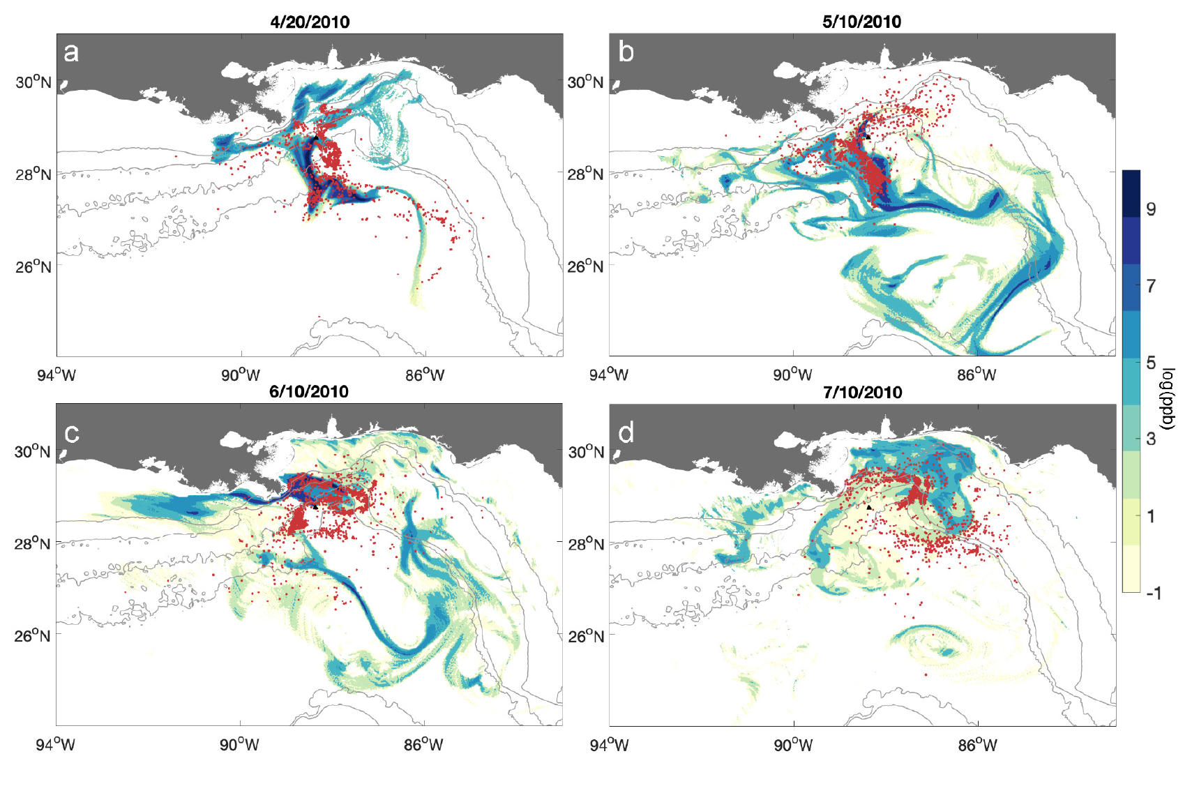
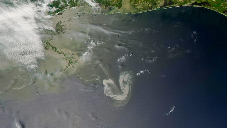
During the Deepwater Horizon (DWH) blowout, photooxidation of surface oil led to the formation of persistent photooxidized compounds, still found in shoreline sediments a decade later. Studies demonstrated that photooxidation modified both biodegradation rates of the surface oil and the effectiveness of aerial dispersant applications. Despite the significant consequences of this weathering pathway, the lack of measurements prevented photooxidation to be accounted for in the DWH oil budget calculations and in most predictive models. Here we develop a Lagrangian photooxidation module that estimates the dose of solar radiation individual oil droplets receive while moving in the ocean, quantifies the likelihood of photooxidative changes, and continues to track the transport of these persistent photooxidized compounds. We estimate and track the likelihood of photooxidation of Lagrangian oil droplets in the upper layers of the water column for the DWH case by coupling the net shortwave radiation from NOGAPS to the oil application of the Connectivity Modeling System (oil-CMS). The dose of solar radiation upon a droplet is computed with the intensity of the incoming irradiance at the ocean’s surface, the light attenuation coefficient, and the depth of the oil droplets. Considering a range of DWH empirical irradiance thresholds, we find that photooxidation can happen at short time scales of hours to days, in agreement with the new paradigm of oil photooxidation. Furthermore, the oxidized compounds are likely to form in a 110 km radius around the response site, suggesting that the oil reaching the coastline was already photooxidized. This new dynamic coupling provides a powerful tool to test oil weathering hypotheses, refine the oil budget during the DWH, and ultimately inform rapid response in future oil spills.

Figure 2 from the Research Study by Vaz et al. (2021) in the Frontiers of Marine ScienceFigure 2 from Vaz et al. (2021):

Photooxidized components (POCs, red dots) probable formation locations, for four release days along the DWH oil spill timeline: (a) April 20th, 2010, (b) May 10th, 2010, (c) June 10th, 2010 and (d) July 10th, 2010. The background colors illustrate the oil concentration (log ppb) at the surface layer (0 to 1 m depth) 20 days after each release date. POCs are considered to form when droplets received a cumulative irradiance dose of at least 6.60*107 J m-2 .

The study was supported by the Gulf of Mexico Research Initiative (GoMRI): C-IMAGE III (Center for the Integrated Modeling and Analysis of the Gulf Ecosystem) and RECOVER 2 (Relationship of Effects of Cardiac Outcomes in fish for Validation of Ecological Risk).

This study was a feature story at the UM/Rosenstiel School news site, and a News Release for the EurekaAlert! by American Association for the Advancement of Science (AAAS) on March 12, 2021.

Deepwater Horizon Oil Spill Satellite image taken on May 9, 2010, by NASA's AQUA satellite

Satellite image taken on May 9, 2010 of the Deepwater Horizon oil spill site in the Gulf of Mexico.

Credit: MODIS on NASA’s AQUA satellite, 9 May 2010 at 190848 UTC. Processed at the UM Rosenstiel School's Center for Southeastern Tropical Advanced Remote Sensing (CSTARS).